Application of multi-scale hyperspectral imaging (iHS) for the exploration and characterisation of multi-metal mineral resources (U, Pb, Zn, Cu, Ba/F) in the Carboniferous-Permian Lodève basin (HyperSP)
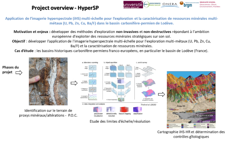
The HyperSP-ResMin research project aims to develop non-invasive and non-destructive exploration methods as part of Europe’s ambition to exploit strategic mineral resources on its soil in order to reduce geo-energy dependency. The aim is to develop the application of multi-scale hyperspectral imagery, in particular variable-resolution imagery (from satellite to point and drone), for multi-metal exploration (U, Pb, Zn, Cu, Ba/F) and the characterisation of mineral resources. The studies will focus on the Carboniferous-Permian Lodève basin (France), with a potential extension to other similar Franco-European basins. The project is being developed in three phases: (1) identification of proxies in the field, (2) study of constraints and scale limitations (resolution), and (3) high-resolution iHS mapping (HR) and determination of geological and geological controls. This non-invasive, non-destructive and rapid technique can provide a powerful mapping guide for exploration.
This project is being carried out mainly by Théo Rubio as part of his PhD.
Project leader : Antonio Benedicto
Funding : contract with ONERA and BRGM
Staff involved at GEOPS
Théo Rubio (PhD student)
Frédéric Schmidt
Collaboration with
ONERA : Sophie Fabre, Hugo Dorbes
BRGM : Aurélien Bordenave